TORNADO OUTBREAK Chase w Dominator 3 + Top Tier Chasers
Published May 9, 2024, 12:02 p.m. by Courtney
Want to be a Member? Click here - https://www.youtube.com/channel/UCV6hWxB0-u_IX7e-h4fEBAw/join
Support the Chase here : https://shopnsc.com/
Get Rapid Radios here : https://bit.ly/rapid-radios-nsc (Save 5% with code DOMINATOR + FREE Shipping)
An outbreak of gorilla hail and tornadoes is expected across the Ozark Mountain region through western Kentucky and Tennessee including memphis and nashville. The Dominator 3 is in full blown tornado intercept mode with a moderate risk issued by the storm Prediction Center. Please please please do not try to track down our chasers. Thank you, and Never Stop Chasing.
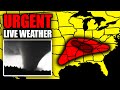
### Today, we have a "hatched area". A "hatched area" means there's a 10% or greater probability of EF2-EF5 tornadoes within 25 miles of a point. Today's hatched area includes -nashville, TN...St. Louis, MO...springfield, MO...evansville, IN...clarksville, TN....(sq mi - 87,144 / pop - 8,923,985)
*** Those outside the hatched area still need to pay close attention today. The storm Prediction Center issues different classes of risk for the probability of a "regular" tornado within 25 miles of a given point. Here they are.
TODAY'S 10% RISK tornado AREA INCLUDES - nashville, TN...St. Louis, MO...springfield, MO...evansville, IN...clarksville, TN...(sq mi - 87,075 / pop - 8,959,977)
TODAY'S 5% RISK tornado AREA INCLUDES - dallas, TX...memphis, TN...arlington, TX...louisville, KY...plano, TX...(sq mi - 186,613 / pop - 19,945,073)
TODAY'S 2% RISK tornado AREA INCLUDES - Austin, TX...Fort Worth, TX...Charlotte, NC...Raleigh, NC...Cincinnati, OH...
Forecast Discussion (sq mi - 200,190 / pop - 24,999,145)
BE WEATHER AWARE TODAY!!! -------
———————————
FOLLOW ON OTHER PLATFORMS, TIP & CONTACT ME HERE:
https://linktr.ee/reedtimmer
-----------------------------------------
Guest Chasers
Edgar - EdgarTheStormchaser.com
Connor - https://linktr.ee/connorcroff
WxChasing - @WxChasing
Guy in the corner - @brianvotoole
You may also like to read about: